Provide Timely Results of Planning/Zoning Requirements
Click here to use the land use application
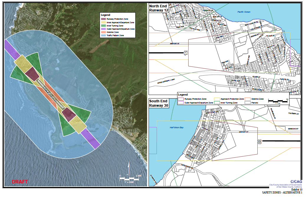
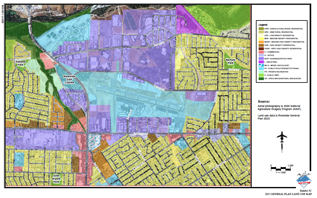
Developers, planners, city council, even members of the community want to know what, if any, land use restrictions are in place in the vicinity of the airport. Our land use analysis application provides those results in an instant. Built off your local zoning and land use data, our map performs the analysis and provides a printable report you can give to your customers or retain for your records. Built on flexible web technology, we can keep it within your organization or make this a public-facing application to serve the community or as part of any E-GOV initiatives.
Please let us save you money and effort by providing timely land use analysis.